Released’WICHI-10′, which can track seamless locations
Long-distance trucks, fishing boats, transportation trains, etc.
Information exchange with short message transmission function
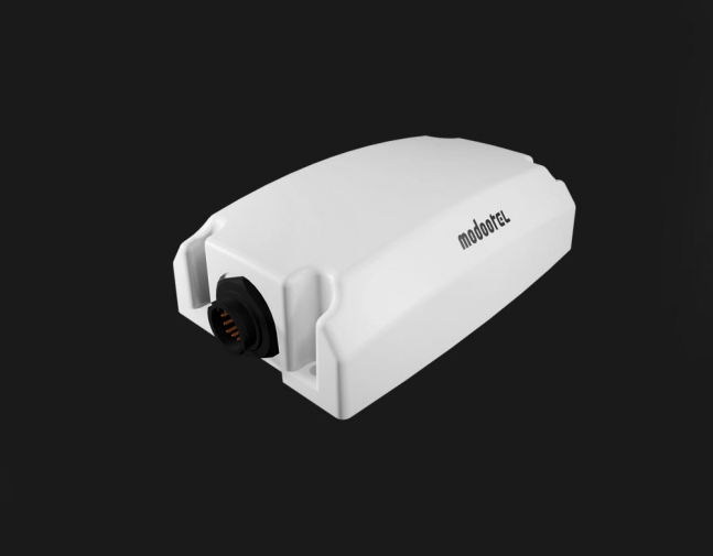
M2M location tracking device developed by alltel based on satellite communication wichi-10
M2M (device communication based on satellite communication) that can seamlessly and easily track the location of moving vehicles between land and sea ) Location tracking device is out. It is expected to contribute to resolving various anxiety factors caused by blind spots in communication, such as leaving the fishing area, disabling the island wallpaper, and losing communication when traveling over long distances.
Madatel (CEO Park Jong-shik), a specialized marine communication company, is equipped with a satellite communication-based M2M/Internet of Things (IoT) device that can be installed on ships, trucks, railroad cars, and light aircraft to determine the current location in real time and check for abnormalities. -10′ was developed and released on the 2nd.
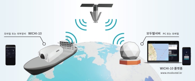
‘WICHI-10’ uses the low-orbit satellite communication network, land Wi-Fi, and global satellite positioning (GNSS) technology to quickly and accurately track the current location and movement of the mobile. The inland uses the land communication network (LTE), and when entering the blind spot of communication, the satellite communication network can be connected and the location can be determined without interruption.
Useful for mobile vehicles that require constant communication, such as offshore fishing vessels, cargo crossing inland and deep seas, long-distance trucks and transport trains to and from the desert, grasslands, and mountainous areas that must comply with fishing zones, including the Exclusive Economic Zone (EEZ). Do it.